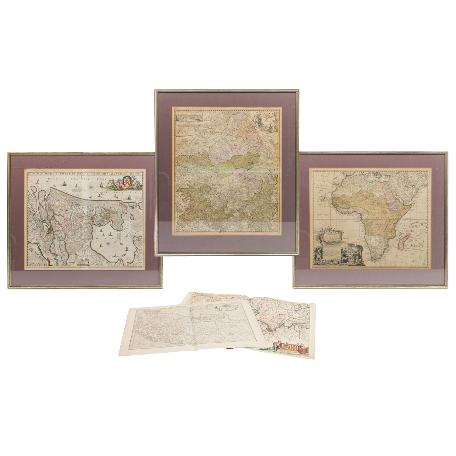
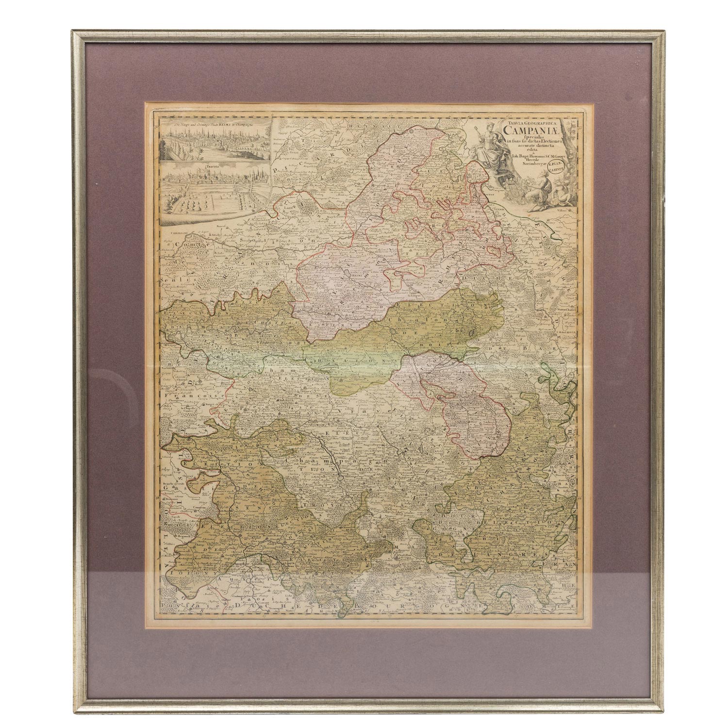
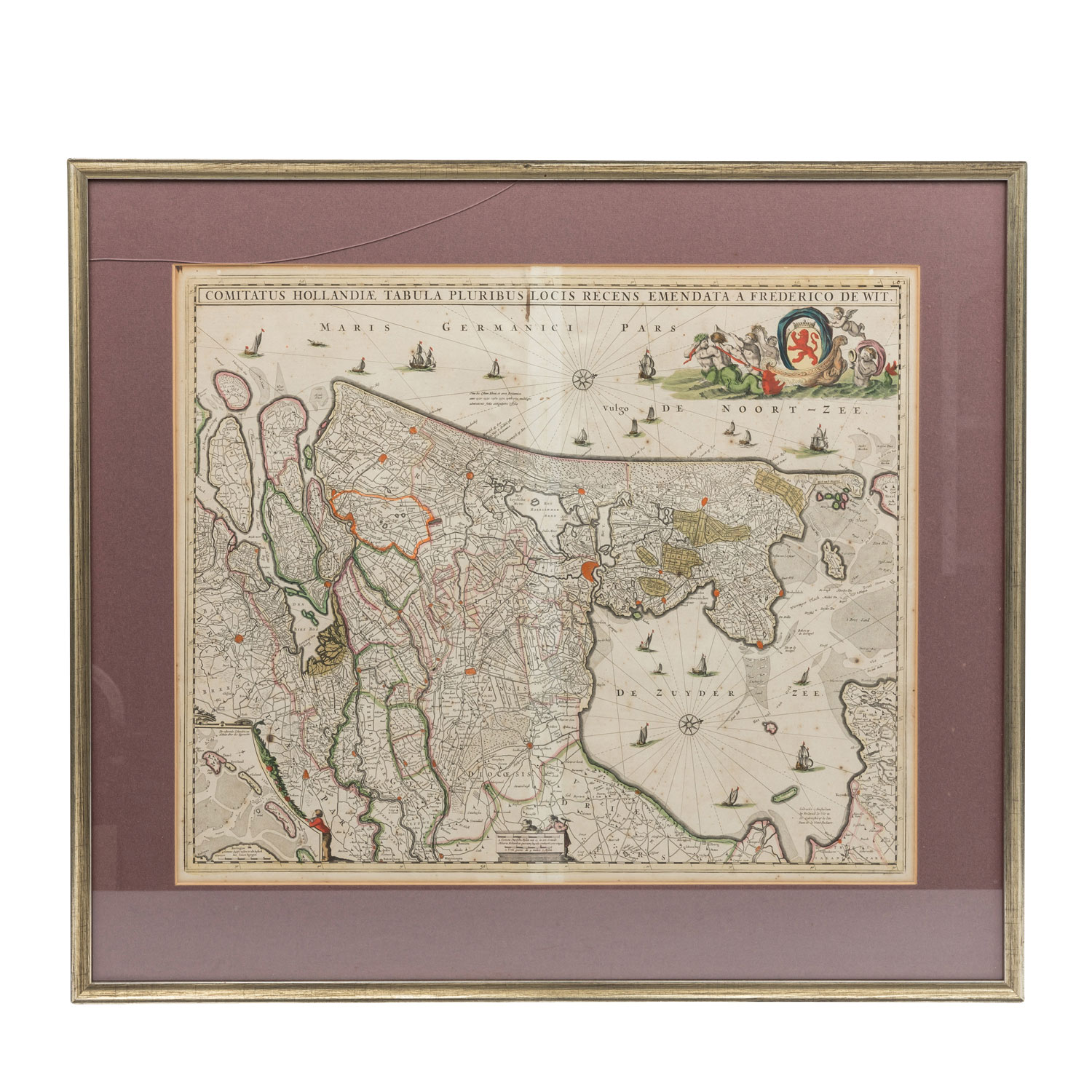
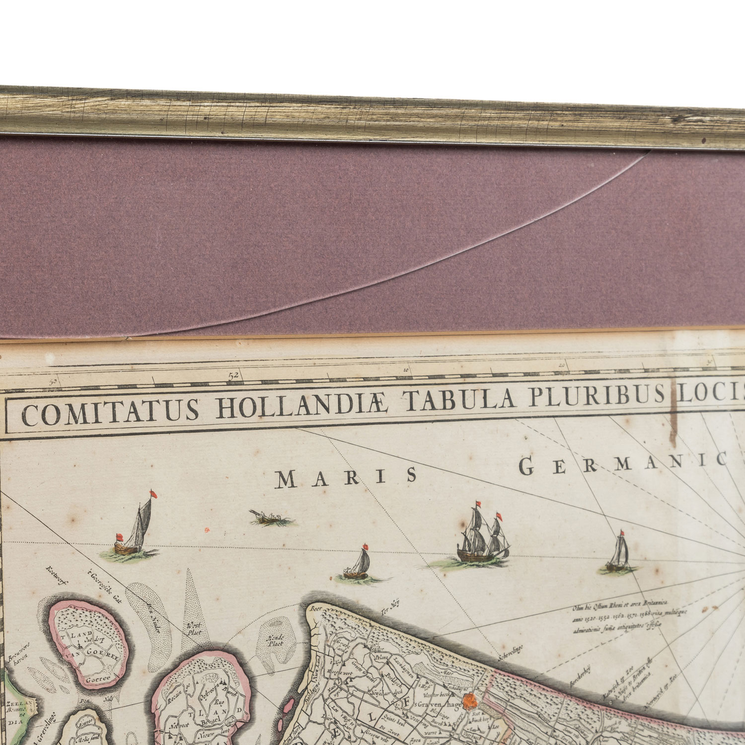
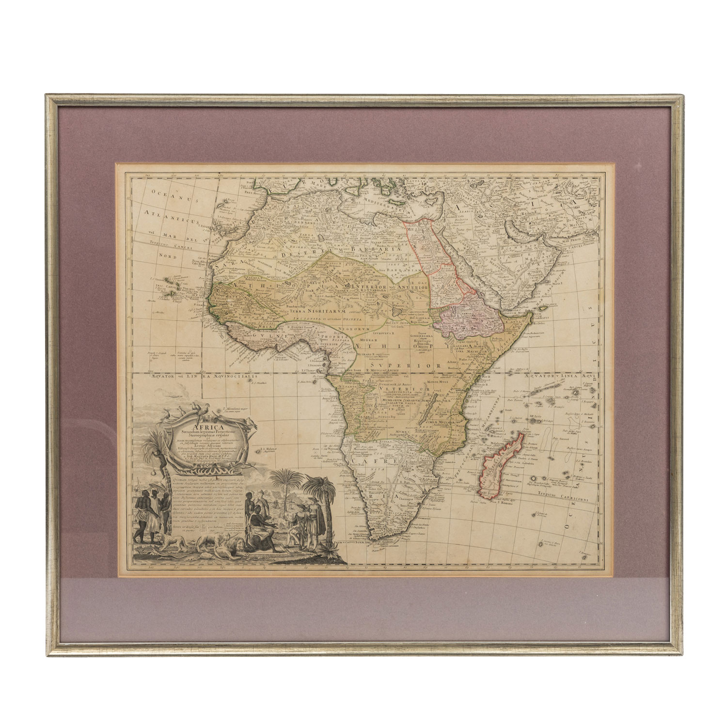
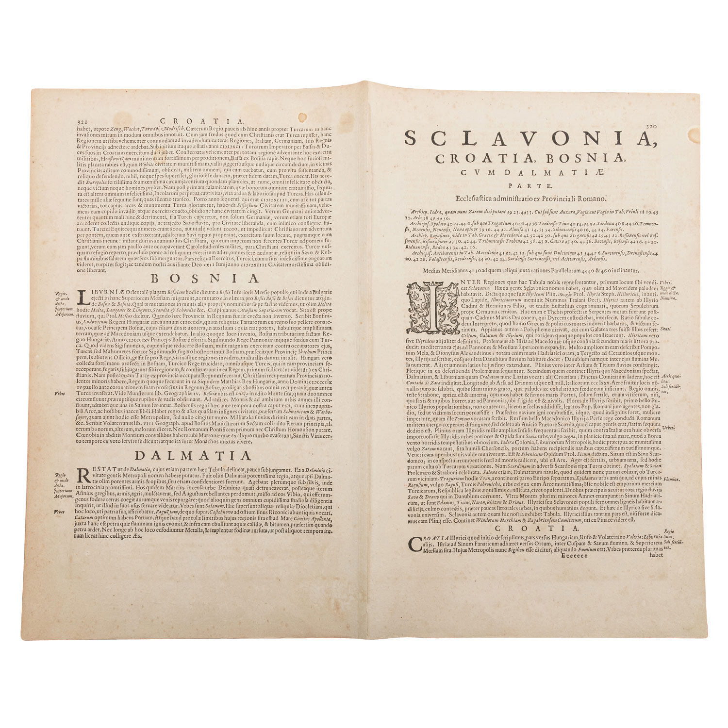
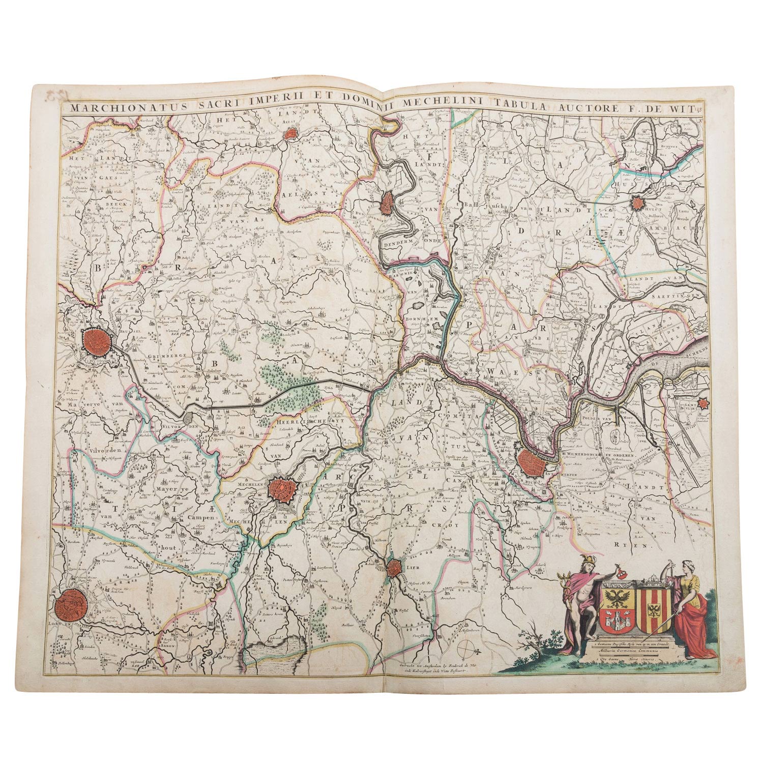
1 x Kupferstichlandkarte Holland "Comitatus Hollandiae Tabula Pluribus locis recens emendata Frederico de Wit", teilkoloriert, Folioformat mit Mittelfalz, Maße mit Rahmen 73cm x 65 cm, Glasrahmen partiell gesprungen. 1 x Kupferstichlandkarte Afrika "Africa secundum legitimas Projectionis Stereographicae regulas", Johann Matthias Haas, Folioformat mit Mittelfalz, Maße mit Rahmen 73 cm x 75 cm. 1 x "Tabula Geographica Campaniae specialis", Johann Baptist Homann, Folioformat mit Mittelfalz, Maße mit Rahmen 67cm x 78 cm. 1 x Kupferstichlandkarte "Marchionatus sacri imperii et dominii mechelini tabula", Belgien, Brabant, Flandern, Mechelen, F. de Wit, Folioformat mit Mittelfalz. 1 x Kupferstichlandkarte "Sclavonia, Croatia, Bosnia cum Dalmatiae parte", nach Gerard Mercator, Folioformat mit Mittelfalz. Stets erkennbare Alters-und Gebrauchsspuren, z.T. stockfleckig, Verfärbungen, Knicke, winzige Löcher. Am besten besichtigen !
| 5-piece set of copper engraved maps, partly hand coloured, 18th/19th century - 1 x copper engraved map of Holland "Comitatus Hollandiae Tabula Pluribus locis recens emendataa frederico de Wit". partly coloured, folio format with centrefold, dimensions with frame 73 cm x 65 cm, partially cracked glass frame. 1 x copper engraved map of Africa "Africa secundum legitimas Projectionis Stereographicae regulas", Johann Matthias Haas, folio format with centrefold, dimensions with frame 73 cm x 75 cm. 1 x "Tabula Geographica Campaniae specialis", Johann Baptist Homann, folio format with centrefold, dimensions with frame 67cm x 78 cm. 1 x copper engraved map "Marchionatus sacri imperii et dominii mechelini tabula", Belgium, Brabant, Flanders, Mechelen, F. de Wit., folio format with centrefold. 1 x copper engraved map "Sclavonia, Croatia, Bosnia cum Dalmatiae parte", after Gerard Mercator, folio format with centrefold. Always visible signs of age and use, partly foxing, discolourations, creases, tiny holes. Best to inspect !
Category::
historical